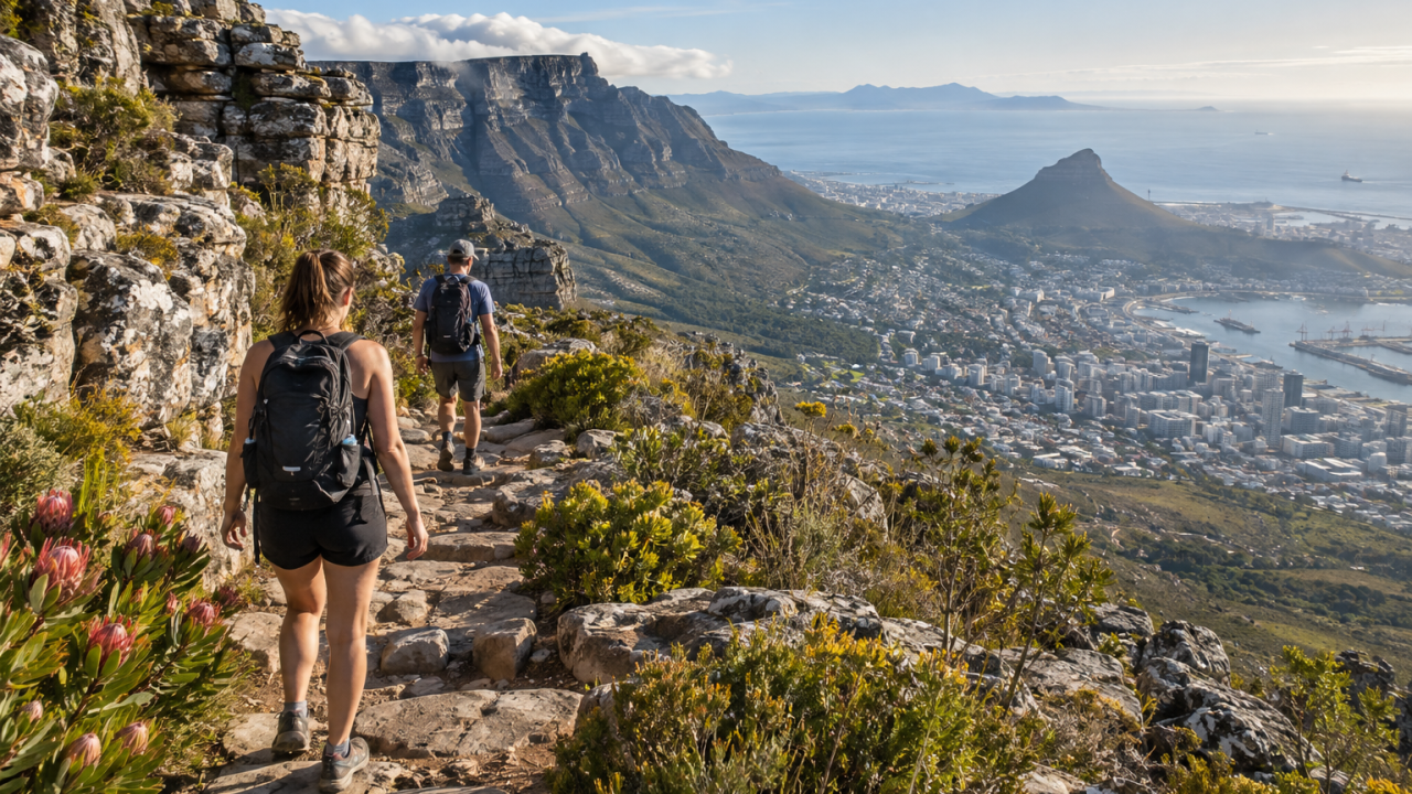
Hiking Table Mountain is one of Cape Town’s defining outdoor experiences, but it should not be approached as a casual walk. Routes vary from steep, exposed climbs to longer paths through forest and fynbos. The right route depends on fitness, weather, daylight and whether you are hiking with children or visitors unfamiliar with the mountain.
Choose the route before you leave
Platteklip Gorge
Platteklip Gorge is the direct route from Tafelberg Road to the Upper Cableway area. It is straightforward to follow but steep, with sustained steps and little shade. The short distance can be misleading; allow time for rests and do not start late.
Skeleton Gorge
Skeleton Gorge begins in or near Kirstenbosch and climbs through forest before reaching the Back Table. It offers a different landscape from Platteklip, but it is still strenuous and can be slippery after rain. Check access arrangements and route conditions before setting out.
The Pipe Track
The Pipe Track is a popular contour route above Camps Bay with dramatic views. It is not a summit route and can include narrow, exposed sections. Treat it as a mountain path rather than an urban promenade, especially in wind or poor visibility.
Mountain safety
Read the latest SANParks Table Mountain National Park notices and check the forecast before leaving. Hike with others, carry water, a charged phone, warm layers and a basic first-aid kit. Stay on marked paths, tell someone your route and turn around if cloud, wind or visibility changes quickly.
Do not rely on a phone signal or assume a busy trail is risk-free. Avoid displaying valuables, keep the group together and plan your descent before sunset. Emergency access and trail closures can change, so follow signs and ranger instructions.
What to pack
Bring more water than you expect to need, sun protection, a windproof layer, food, a map or offline route and shoes with reliable grip. Even a warm City Bowl morning can feel cold and wet on the mountain. Cableway tickets are separate from hiking, and some park sections have conservation fees, so check the exact starting point.
Final advice
Choose a route that matches the slowest person in your group. Table Mountain rewards patience, but no viewpoint is worth ignoring weather, fatigue or a closure.
How to judge conditions
Table Mountain creates its own weather. A clear forecast in the city does not guarantee clear conditions on the upper slopes, and the famous “tablecloth” cloud can arrive quickly. Wind, rain and low cloud reduce visibility and make rock surfaces slippery. Check a current forecast immediately before leaving, and reconsider the route if conditions are deteriorating. A cableway closure is also a useful warning that conditions may be unsuitable, not an invitation to find a more difficult way up.
Planning the ascent and descent
Many visitors focus only on reaching the top and underestimate the descent. Set a turnaround time, keep enough daylight for the return and avoid splitting the group. A route that looks short on a map can take much longer when it includes steep steps, scrambling, heat or frequent rests. If you are new to the mountain, a qualified local guide can help with route choice, navigation and changing conditions.
Navigation and emergency preparation
Download an offline map and tell someone outside the group where you are going. Do not leave marked paths to create a shortcut, and do not follow an unfamiliar track simply because it appears busy. Carry a charged phone, but remember that reception is not guaranteed. If someone is injured or lost, keep the group together where safe, note landmarks and contact emergency services rather than attempting a risky improvised descent.
Responsible access
Table Mountain National Park protects sensitive fynbos and wildlife. Keep dogs, bikes and fires to areas where they are permitted, carry all rubbish out and avoid picking plants. Busy paths can become congested, so give uphill hikers room and be patient on narrow sections. Respect closures: they may protect visitors from rockfall, fire, flooding or conservation work.
A realistic day plan
For a first visit, start early, choose one well-understood route, pause regularly and leave the summit before afternoon weather builds. Carry food and water for longer than your expected duration. Check the official park notices, transport arrangements and cableway information on the day, then tell your accommodation or a friend your plan.
Leave a Reply